Governments, environmental organisations, businesses and researchers are increasingly looking for ways to access premium geospatial data. Across different sectors, planning, mapping, decision-making and monitoring have seen a great improvement thanks to spatial intelligence and high-quality satellite imagery. The section below focuses on modern geospatial platforms that offer advanced data services, allowing organisations to access reliable insights.
Premium geospatial data for insights
Companies in the past relied heavily on aerial photography, traditional surveying methods, manually collected field data and public records to access meaningful geospatial information. These methods were very reliable but often expensive, slow and limited in coverage. That has changed recently with organisations shifting toward satellite-based services and advanced spatial intelligence platforms like space-solutions.airbus to access premium data efficiently. Organisations can now gather detailed geographic information with great accuracy and speed thanks to technological advancements like real-time monitoring, cloud-based analytics and high-quality satellite imagery. As companies in different industries (including energy, environmental management, construction, disaster response and agriculture) continue to depend heavily on precise location data, this transformation is becoming essential in terms of operations, planning and sustainable decision-making.
Companies use spatial intelligence to support urban planning projects, track environmental changes, monitor infrastructure and improve logistics. High-resolution satellite imagery, on the other hand, helps businesses reduce operational costs, detect risks early and enhance resource management. With global challenges (population growth, infrastructure expansion and climate change), businesses, now more than ever, need up-to-date and reliable geospatial information. Because of that, modern geospatial platforms blend mapping tools, satellite technology and analytics to offer more in-depth insights.
What makes geospatial data premium?

Premium in terms of geospatial data is largely defined by freshness, accuracy, reliability and detail. Compared to normal or basic geographic data, premium information often comes from professional data processing systems, high-resolution satellite imagery and advanced sensors. It means that this type of data offers detailed views of weather patterns, landscapes, environmental changes and infrastructure. The quality of geospatial data helps businesses and companies make informed decisions based on up-to-date and more precise information.
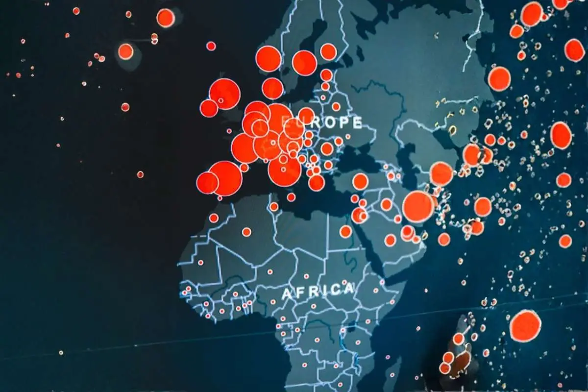
Another vital aspect that defines premium data is the ability to support real-time monitoring and advanced analysis. This means that governments and businesses can use it to monitor projects, track land use, respond to natural disasters and manage resources with more efficiency. Premium data also benefits from regular updates, making it useful for companies that rely on current information. Therefore, high-quality data is becoming an essential tool for large-scale operations, risk management and planning across different industries.
Modern geospatial intelligence: transforming planning and mapping
Modern geospatial technologies are revolutionising how businesses collect, analyse and leverage location-based data. Spatial intelligence and satellite imagery are playing a great role in supporting growth, from city development to business strategy.
Enhancing Business Decisions
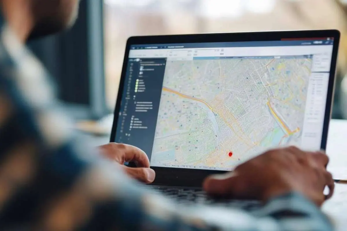
Through combining analytics with geographic data, spatial intelligence helps organisations understand risks, patterns and trends. As a result, businesses improve logistics, manage supply chains, monitor assets and choose better locations more effectively.
For instance, energy companies can monitor remote and pipeline infrastructure, while businesses in the retail sector study and understand customer movement patterns. When companies access high-quality data, they can reduce operational uncertainty and react faster to changes.
Smart Mapping
Satellite imagery forms an important part of modern mapping by offering regular and detailed updates of the surface of the Earth. Satellite-based systems, unlike traditional mapping methods, cover larger areas quickly and capture information even in difficult or remote locations. Experts use high-resolution imagery to track environmental changes, detect natural disasters, monitor land use and map infrastructure.
Additionally, modern satellites collect data in different lighting and weather conditions, enhancing the ability of mapping (more consistent and reliable). Because of that, geographic information systems used in major industries like environmental management, mining, agriculture and transportation have improved in terms of accuracy.
Building Better Cities
Spatial intelligence is widely used by urban planners to design more sustainable, safer and smarter cities. This is possible because geospatial data collected helps planners understand environmental impacts, population growth, traffic flow and land development better and before projects start. Mapping tools and satellite imagery can be used, especially by big and busy cities, to monitor public infrastructure, enhance transportation systems and manage natural resources more effectively.
Challenges when accessing reliable geospatial data
Outdated Information and Data Accuracy
Finding updated and accurate geospatial data is one of the main problems companies face. Many industries access low-resolution imagery and/or outdated maps, which, in turn, lead to costly mistakes and poor planning. Businesses in sectors like transportation, construction, environmental monitoring and agriculture need up-to-date information to make reliable decisions. This doesn’t mean that every available dataset offers the same level of detail, consistency and/or quality.
Natural disasters, infrastructure development, urban growth and climate change can cause geographical conditions to change, creating another problem. Therefore, organisations that rely on incomplete or old data may struggle to make informed decisions or respond effectively to these changes.
Costs, Access and Integration
Many companies find it hard to gain access to premium geospatial data since most advanced satellite imagery and datasets are complex to manage and/or expensive to acquire. Geospatial data comes from different sources, each using a unique format, making it more difficult to integrate with existing systems. This means that businesses will incur additional costs to cater for skilled experts and specialised tools to interpret and analyse spatial information correctly.
Another challenge arises when it comes to balancing data quality with cost. While companies can get free datasets, they may not benefit from the coverage and accuracy required for large-scale operations. Because of that, organisations must invest in more reliable and premium geospatial solutions that offer long-term value and better insights.
The future of geospatial services and cloud-based platforms
With the emergence of cloud-based geospatial sites, companies can easily access, analyse and store large amounts of spatial information in real time. These platforms have several things in common, including scalable data processing, faster collaboration and remote access. As Artificial intelligence and satellite technology continue to develop, cloud-based services are expected to continue enhancing business intelligence, mapping and environmental monitoring in the years to come.
Conclusion
Premium geospatial data form an important part of the resources that modern industries require for monitoring, accurate mapping and analysis. Companies can access detailed and more reliable geographic insight more easily than before as cloud-based technologies, spatial intelligence and satellite imagery continue to grow.